
Whitpain ZIP Code Coverage
The verified local picture is deliberately narrow. The Whitpain Township Comprehensive Plan says that most of Whitpain Township is covered by Blue Bell, Pennsylvania 19422. That establishes 19422 as the principal documented postal code, not as an all-purpose municipal boundary. The research did not find an authoritative township ZIP-boundary map or a USPS address-level result that established a complete list of other serving codes. A reliable ZIP code directory should preserve that limit instead of turning an older form or neighboring postal label into a second confirmed coverage area.
| ZIP code | Verified area or postal community | Postal-boundary note | Record-search use |
|---|---|---|---|
| 19422 | Blue Bell; the official plan says it covers most of Whitpain Township. | USPS delivery geography, not an incorporated township boundary. | Validate the full address, then use county address or parcel tools. |
| Any additional serving ZIP | Not confirmed in the inspected official material. | An older permit packet showing 19426 conflicts with current Township materials using 19422. | Do not treat it as local coverage until USPS confirms a specific address. |
Blue Bell, Broad Axe, Centre Square, and West Ambler are all useful Whitpain location words. The Township's planning framework recognizes the four village areas, but a village name, a postal community, and a legal jurisdiction are not interchangeable. Preserve the complete address as written on a document, then add Whitpain Township and Montgomery County when entering county records.
Whitpain ZIP Code Is Not a Township Line
A ZIP code is created for mail delivery. A township is a local government jurisdiction. The Census Bureau's ZIP Code Tabulation Area, or ZCTA, is an approximation used for statistical mapping and is not the USPS delivery boundary itself. That means a Blue Bell mailing address can be a postal descriptor while the tax and recorded-document jurisdiction depends on the parcel's actual municipality. The Comprehensive Plan's use of “most” is an important local clue: 19422 should not be treated as a map that automatically includes all of Whitpain or excludes every address that needs Whitpain research.
Use the USPS ZIP Code Lookup for delivery confirmation of one complete address. Use the Montgomery County Data & Mapping Services and township materials for map and jurisdiction context. A tax map helps show spatial relationships but does not establish a boundary on the ground. Only a licensed survey establishes that legal line.
Note: A postal label can be valid for delivery and still be insufficient for identifying the correct township record custodian.
Whitpain ZIP Code Directory Address Keys
The Whitpain ZIP code directory becomes useful only after the address is broken into record keys. A situs address is the physical place or property label. A mailing address is a correspondence field and can differ from the physical location. A legal description is the recorded land description, often more durable than a street-number format. County property records begin with a street address or parcel number; the Recorder can use address or parcel ID after sign-in; township permit and zoning materials can show a project location and parcel code. Pair the normalized street address with Whitpain Township, the parcel ID, and a recorded legal description when available.
- ZIP code and ZIP+4
- A ZIP code identifies a delivery area; ZIP+4 adds a more specific delivery segment and does not establish township jurisdiction.
- PO-box ZIP
- A postal code assigned for post-office box delivery, which may not describe a street-delivery area.
- Unique ZIP
- A code used for a single organization or delivery arrangement, not a general neighborhood boundary.
- Carrier route
- A postal delivery grouping, useful to postal operations but not a resident roster or municipal map.
- Situs address
- The physical property address, separate from a correspondence address or legal land description.
A mailing address should not be treated as proof that a person occupies a property. Similarly, a deed party or parcel record is not a household census. The local ZIP angle is an address-validation step, not a way to make a list of people.
Working a Whitpain ZIP Code by Address
A complete, verified address is the bridge from the postal system to Whitpain records. No locally verified property, Recorder, GIS, or voter portal in the research offered a ZIP filter. The safest workflow therefore starts with USPS delivery confirmation and then uses the official address or parcel routes that the county actually documents. Once a ZIP has narrowed the mailing question to an address, the detailed by-street work belongs with the Whitpain streets directory.
- Confirm the full street address in the USPS lookup. Preserve the postal community and ZIP as delivery data, not as a township conclusion.
- Search County Property Records by the street address or parcel number. Keep Whitpain Township in the notes because street names can repeat in Montgomery County.
- Use the parcel identifier with the county GIS and, when the question concerns a recorded document, the Recorder Public Access System.
- Compare the parcel's municipality, address format, and legal-description connection before asking a custodian for a document or historical record.
The County Property Records interface explicitly supports street address and parcel number. The Recorder's published instructions name address, parcel ID, and name criteria after authentication. Those are useful record trails, but none should be represented as a ZIP-wide people search.
Whitpain ZIP Records Have No Promised Filter
The available county descriptions support a precise claim and no more. The public property page describes parcel-number and street-address search. The Recorder describes name, address, and parcel-ID criteria after an account is created. Data & Mapping provides public geospatial data and an interactive tax map, but the inspected source does not publish a ZIP-filter control. No verified ZIP-filtered voter, property, Recorder, or GIS mode was found. A truthful Whitpain ZIP code directory says so plainly rather than guessing at filters that may not exist.
| Official entry point | Verified search or map path | ZIP-filter status |
|---|---|---|
| County Property Records | Street address or parcel number | Not documented. |
| Recorder Public Access | Name, address, or parcel ID after account sign-in | Not documented. |
| County Data & Mapping | Public GIS data and interactive tax-map context | Not documented. |
| Voter records | Self-status form or statutory list request | No verified ZIP mode found. |
For permitted voter records, the individual status tool is self-confirmation. County or statewide voter-list requests have statutory use and nonpublication conditions. They are not a replacement for address verification, and a ZIP label does not remove any confidentiality protection.
Whitpain ZIP Code Maps and Villages
Whitpain's geography gives a local reason to preserve more than one place label. The Township identifies Blue Bell, Broad Axe, Centre Square, and West Ambler as the four villages within the community. Older documents can use a village or road description that does not match a present postal expectation. The Township's government and planning materials publish current municipal resources, while county GIS gives parcel and spatial context. Use both with the exact postal address instead of forcing a historic label into a modern ZIP field.
The Township publishes street, zoning, floodplain, sanitary-sewer, open-space, traffic, and planning maps. The research did not verify a local E911-addressing authority or a historical street-renumbering year. Do not assume a particular office assigns every new address or that an old number changed on a known date. Compare the current street label with the parcel, deed legal description, and period map when an older document conflicts with postal formatting.
Whitpain ZIP Code Public-Safety Search Limits
Pennsylvania's Megan's Law public-safety registry offers a ZIP or address-oriented search route after its terms are accepted. The registry exists for public protection, not for personal pursuit. Its terms warn that information can be incomplete or outdated, that a positive identification requires fingerprints, and that threatening, intimidating, harassing, or otherwise misusing the information can create criminal or civil liability. For an urgent danger, contact the appropriate emergency or law-enforcement agency instead of trying to resolve identity from a map result.
The Pennsylvania registry ZIP-search screen is an official public-safety entry point, not a source for building a Whitpain Township resident list.
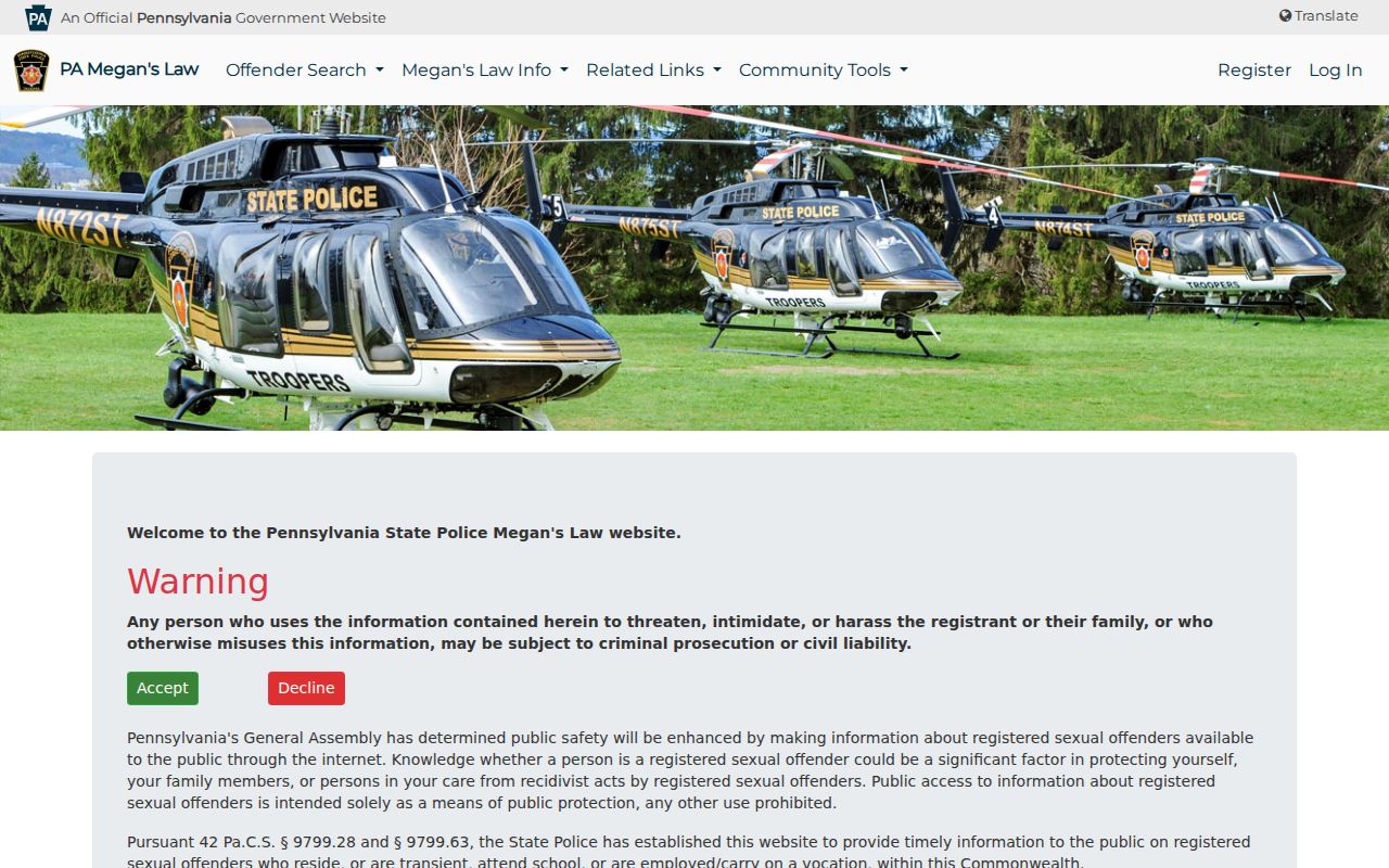
The screen reinforces why ZIP geography must be handled with care. A registry's delivery or proximity route does not prove a person lives at a particular Whitpain address, and it must never be used to threaten, confront, or harass anyone.
Use the right channel. Public-safety information is for immediate protection and official reporting. It is not permission to track, confront, or expose a person based on a ZIP search.
Whitpain ZIP Code Directory Boundaries
Postal verification is the first check, not the final answer. For a current address, preserve the USPS result, then confirm the Whitpain Township and Montgomery County connection through the parcel and municipal record trail. For an old record, retain the village or postal wording as it appears, but test it against the recorded legal description and county map context. This distinction is especially important where a same street name appears in another municipality or where a historical document used a locality label that does not match current delivery conventions.
Only 19422, covering most of Whitpain according to the official plan, is verified in the local research. The older 19426 reference is not enough to claim another serving code. This limited coverage table is more useful than an unverified list because it tells a researcher exactly when to pause and confirm the delivery address with USPS before proceeding to a county record.
Note: ZIP code data narrows a postal question; the parcel, municipality, and custodian establish the record jurisdiction.