
Following a Whitpain Township Street Directory Address
A reliable street-by-street search in Whitpain starts with the place, not a surname. Montgomery County deliberately removed public owner-name searching from its assessment tool, so an address is the practical bridge to a parcel identifier. That identifier can then connect the property record to the Recorder’s instrument index and to map context. A recorded party may be a buyer, seller, trust, estate, or business. Treat it as evidence about a recorded transaction, not an occupancy claim.
- Enter the exact Whitpain Township street address in Montgomery County Property Records and note the parcel number and municipality.
- Use the parcel and street context in the county’s Data & Mapping Services resources to understand nearby roads, parcels, and municipal geography.
- Create an account for the Recorder’s Public Access System, choose Search Public Records, and use the verified address or parcel criterion.
- Read a located instrument for its recording reference and prior-reference language, then work backward through recorded transfers when the question concerns title history.
- Use the lawful Voter Services request route or local historical repositories only for the limited question each source can answer.
That order keeps a street directory search tied to stable land-record identifiers. It also avoids guessing from a common name, a nearby house number, or a postal label that may not match the legal municipality.
Whitpain Township Street Directory Search Fields
The public assessment route has two documented entry paths. It accepts a street address or a parcel number. Owner is not a third option: Montgomery County removed owner-name search effective June 17, 2022. The public research did not verify wildcard rules, sort controls, or the fields on a returned parcel card, so a careful search stays within the controls the county actually documents.
| Field or tool | Use in the address trail |
|---|---|
| Street Address | One public search route. Use the official street spelling and keep Whitpain Township in the research notes. |
| Parcel Number | The other public search route. Carry this identifier to the Recorder and GIS resources. |
| Owner | Unavailable as a public search mode. It was disabled for privacy and should not be presented as an option. |
| Interactive tax map | A visual map resource for spatial relationships, not a surveyed statement of a legal boundary. |
| Custom report or map | An optional request to BOA.datarequests@montgomerycountypa.gov; the county quotes programming, labor, and material costs before work. |
The county’s Property Records notice is the source for the address and parcel routes. It does not promise an owner mailing address, sale field, sketch, or other parcel-card detail, so none of those should be assumed from a street directory result.
The county’s posted property-search rules show why the Whitpain Township street directory begins with an address and parcel number rather than a name search.
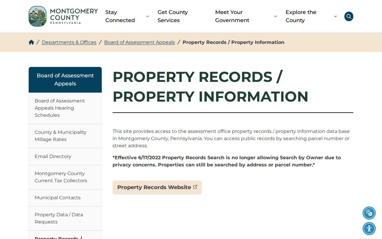
The notice supports an address-first workflow while leaving uninspected result details to the custodian.
Whitpain Township Records by Street Address
Each address-keyed source has a narrower job. The property record establishes the current parcel route. GIS puts that parcel into map context. A Recorder instrument can document a title event, while township development material can show a dated project or application at an address. The distinctions matter because no one source is a complete household record.
| Address-keyed record | Custodian | What it can establish | Access and limit |
|---|---|---|---|
| Current property record | Board of Assessment Appeals | Address or parcel match and the current property-record route | Public address/parcel search; owner search is disabled. |
| Parcel map and GIS layers | Data & Mapping Services | Relationships among parcels, roads, and municipal areas | Public visual tool; a licensed survey controls the boundary. |
| Recorded instruments | Recorder of Deeds | Deed, mortgage, satisfaction, and title-chain entry | Account required; remote images have a subscription condition. |
| Tax bill route | Whitpain tax bills and receipts | Bill copy by parcel number or street address | A prior bill may not reflect a newer sale. |
| Planning or zoning file | Whitpain Township Zoning Hearing Board | Application number, published applicant, address, and hearing or decision timing | It is project evidence, not a household list. |
| Historic local ledgers | Wissahickon Valley Historical Society | Whitpain tax volumes and supervisors’ records | Collection contact or reading-room access, not a current search. |
The same street directory evidence can therefore mean different things at different points in time. A tax bill reflects a billing route, a deed reflects an instrument, and a zoning application reflects the named role on that application. Compare like with like before drawing a conclusion.
Whitpain Township Street Map Context
Montgomery County Data & Mapping Services maintains the public geospatial portal, open-data access, and the interactive tax-map route. The county describes the map as a way to understand spatial relationships between properties. It is useful when a street name repeats elsewhere in the county or when a parcel must be placed beside roads and municipal layers.
The map is not a boundary survey. The county expressly says that only a licensed survey establishes a boundary on the ground. Research also did not verify an address box, parcel-selection control, buffer tool, export control, or layer list in the embedded live viewer. Pan, zoom, or consult the visible map context without promising tools that were not inspected.
The county GIS and data-services entry point provides the visual side of a Whitpain Township street directory search.
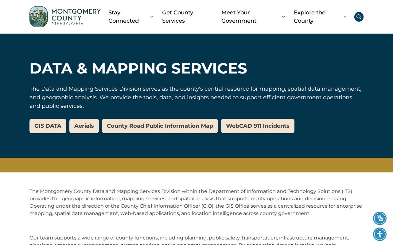
Use its map context with the parcel identifier, then verify legal boundaries through the appropriate survey or recorded source.
Whitpain Township Street Deed Chain
The Montgomery County Recorder of Deeds Public Access System is the recorded-instrument route after an address or parcel has been identified. The county says users create an account, log in, and choose Search Public Records. Its documented criteria include name, address, and parcel identification number. For a street trail, the address and parcel criteria keep the search tied to the right property before a party name is used as a follow-up clue.
Recorder records date to 1784. Remote images require a subscription: $25 for a calendar day ending at midnight or $300 for a month. A subscriber may buy or print a plain page for $0.50. An e-certified copy costs $10.50, is available immediately after purchase, and remains in a queue limited to ten items. The public research did not view the authenticated result grid, so it is accurate to describe a recorded instrument index without promising every displayed column.
The Recorder login and search entry is the account gate for the Whitpain Township street directory deed route.
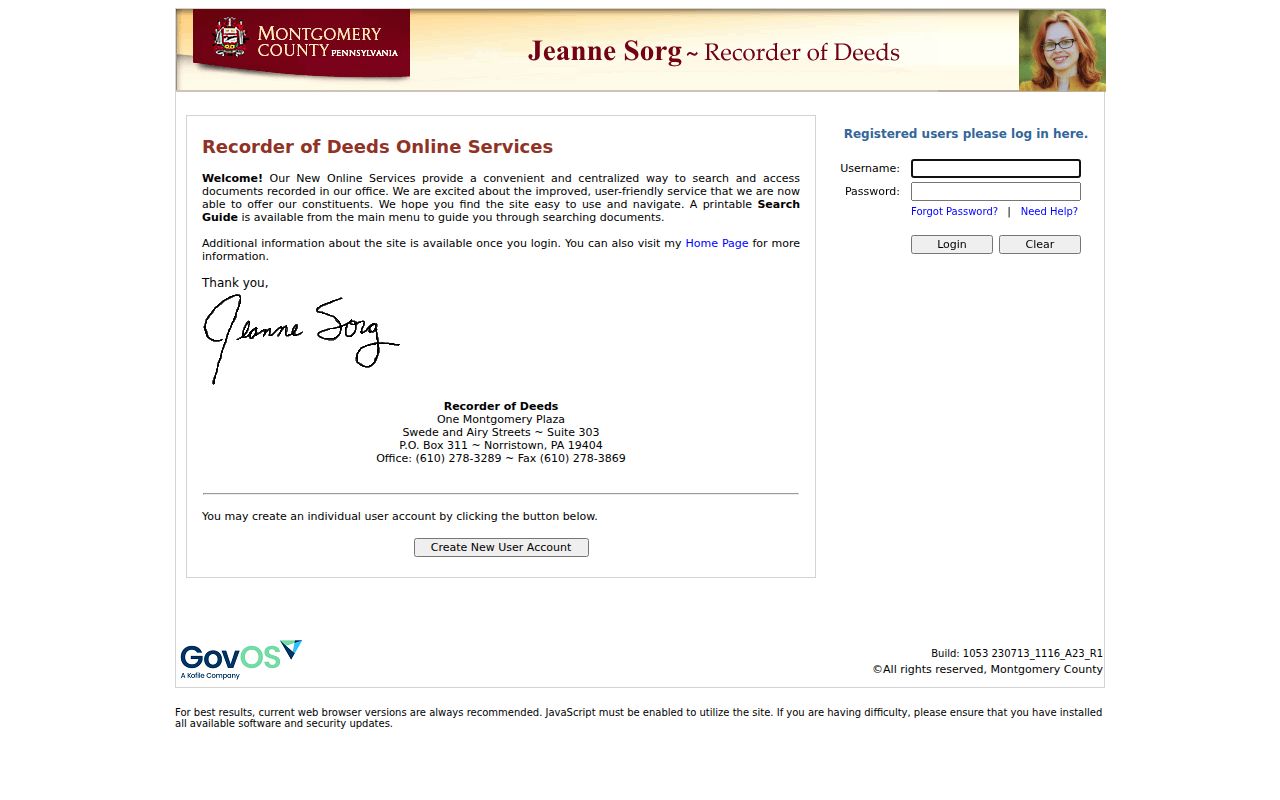
When remote access is not enough, the Recorder counter, County Archives, Historical Society of Montgomery County, and Wissahickon Valley Historical Society are documented historical-research fallbacks.
Note: The Recorder’s direct fraud-protection phone is 610-278-3289, and a parcel ID is the county’s recommended identifier for a FraudSleuth profile.
Whitpain Township Zoning Address Files
Whitpain Township publishes address-forward planning material through its pending and active subdivision and land-development list and its Zoning Hearing Board. A typical zoning list item can identify the application number and year, applicant label, street-address label, hearing date, grouping as pending or recent, and sometimes a decision link. Some inspected links carry a redacted filename marker.
That makes the material useful for a public project chronology at one address. It does not establish that an applicant, owner, agent, attorney, or contractor resides there. Preserve the application number and date so the exact public record can be checked again.
Whitpain Township zoning-hearing records place named public applications beside their address and timing.
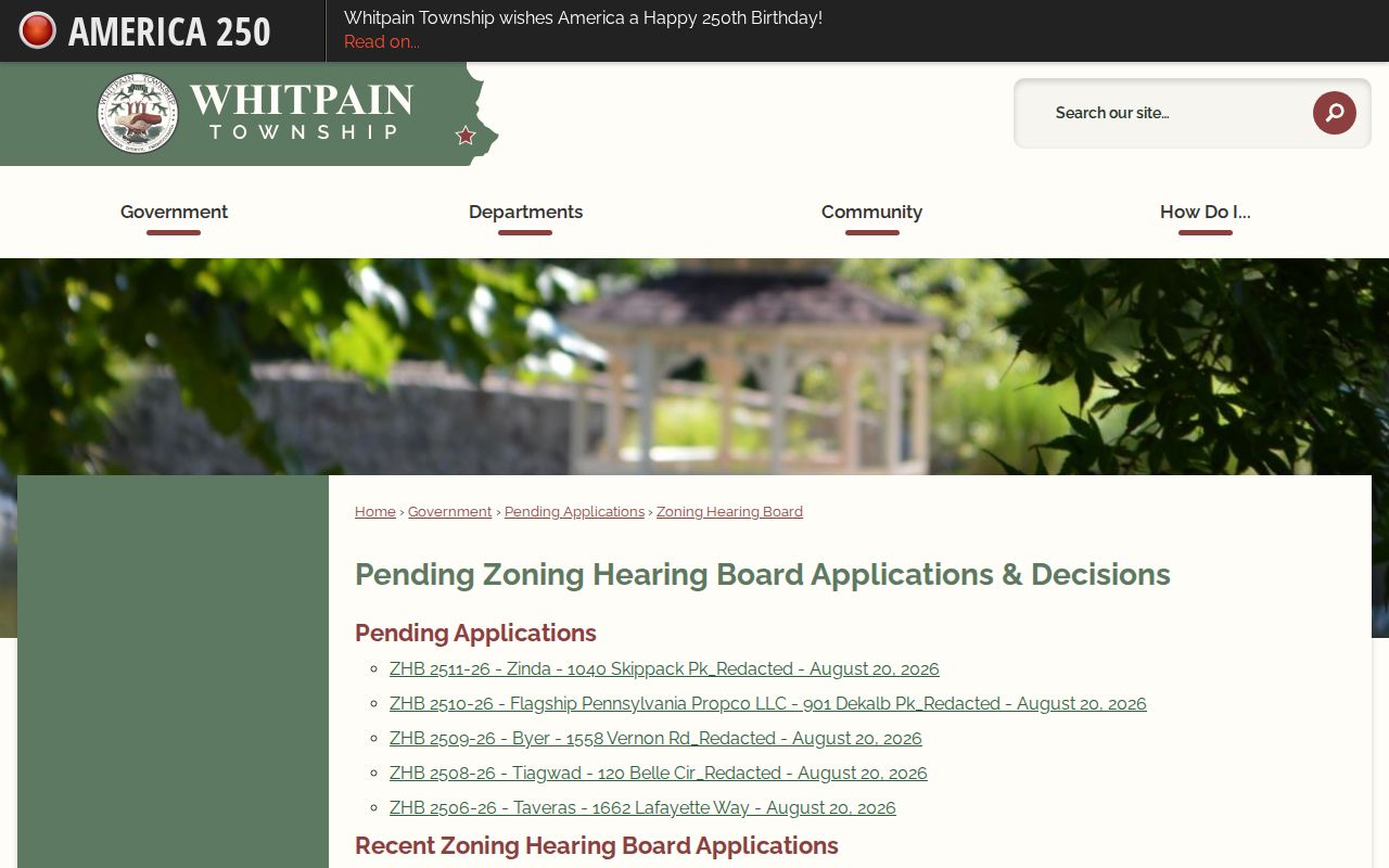
The address label helps position a planning file in the street history, while redactions and role differences limit what may be inferred about people.
Whitpain Township Permit Address Route
Whitpain Township Code Enforcement receives permit applications and plans, issues permits, conducts inspections, and issues Certificates of Use and Occupancy. It administers building, plumbing, mechanical, fire-protection, electrical, property-maintenance, and zoning-related code work. The official public site does not offer a universal individual permit search, so a complete address and narrow request are more useful than a broad name request.
A published monthly permit report can show project location, parcel code, property-owner and contractor labels, permit type and status, issued and expiration dates, fees, and work description. Exact fields vary by report and redaction practice. For a defined document, use the Code Enforcement staff channel at codes@whitpaintownship.org or make a targeted Right-to-Know request that states the address, date range, permit type, and document sought.
The Township Building Code page explains the permit and inspection context for a Whitpain Township street directory address.
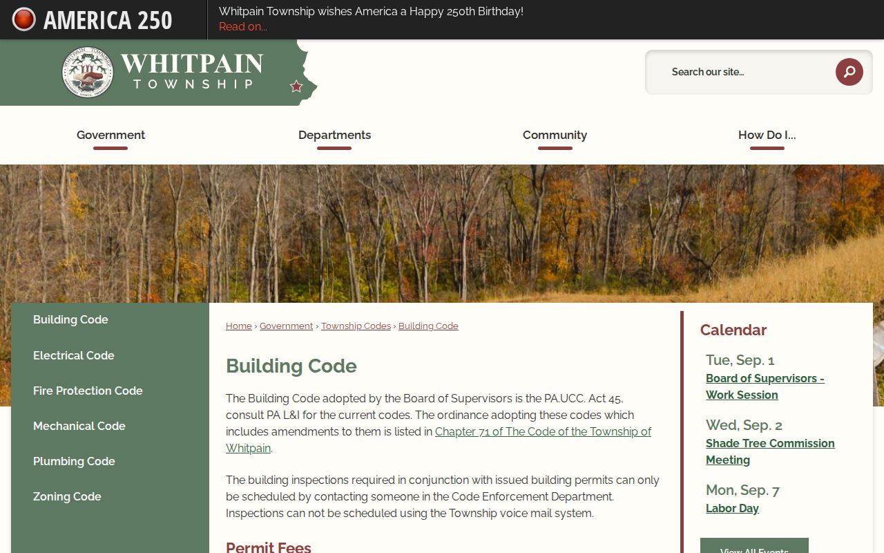
The Township lists a maximum residential processing time of 15 business days and commercial permit processing time of 30 business days, subject to workload, completeness, scope, and complexity.
Whitpain Township Street-List Conditions
Pennsylvania provides a statutory request route for voter street lists, but it is not a public web-publishing route. The statewide Street List is described as containing name, residential address, mailing address, party, and active or inactive status. The county version is described as name and residential address in the currently indexed form. Ask Montgomery County Voter Services for the current request procedure rather than treating a status checker as a list search.
Requesters affirm use conditions under 25 Pa.C.S. §§ 1207(b) and 1404(c)(2). The related regulations, 4 Pa. Code §§ 183.13(g) and 183.14(k), restrict internet publication. Address Confidentiality Program participants may use substitute addresses. These limits mean a voter record can be a controlled research source, not material for a public block roster.
Whitpain Township Street Directory Address Labels
Whitpain Township is not the same thing as a postal-city boundary. The township plan says most of Whitpain is covered by Blue Bell, Pennsylvania ZIP code 19422, but postal community, township, and parcel municipality are separate facts. A historic clipping may use Blue Bell, Broad Axe, Centre Square, West Ambler, or another village label while county property work is tied to Whitpain Township and Montgomery County.
Store the exact street spelling, parcel identifier, municipality, postal label, document date, and source together. That basic discipline prevents an address search from drifting to a like-named road elsewhere or from treating a modern postal label as an old legal description.
Whitpain Township Historical Address Sources
The former Historical Society of Whitpain collection is now held by the Wissahickon Valley Historical Society at the 1895 Public School in Blue Bell. Its finding aid identifies a 1778–2011 collection that includes Whitpain tax volumes for 1899 and 1900 and Board of Supervisors records for 1901–1907. WVHS also describes books, ledgers, deeds, mortgages, maps, tax maps, newspapers, yearbooks, church and cemetery material, and local building records.
Those sources give a past-address trail context that a modern parcel search cannot supply. No verified Whitpain directory title and year run, or verified reverse-directory shelf, was found. For old household material, ask WVHS or the Historical Society of Montgomery County to identify a specific title, edition, call number, and access condition before relying on it. The historical collection side is covered in more depth in the Whitpain Township city directory collections.
Montgomery Recorder Missing Volumes
An empty book-and-page retrieval does not always mean an address trail failed. The Recorder identifies unavailable Deed Books 1325, 1326, 1377–1381, and 1540–1544; Mortgage Books 1572–1580, 3340, and 3454; and Plan Books 16–21. Charter Books are 1–19. MISC Books begin with Book 20 after 2000, while MISC Backfile Books are 1–131 and refer to the Charter Index.
Check the cited book range before treating a gap as evidence about a property or a person. The Recorder counter, its historical-research resources, County Archives, or a historical repository may help determine the next source to consult.
Limits of a Whitpain Township Street Directory
A property record, title party, planning applicant, and voter-list entry each describe a different public-record relationship. None enumerates every person in a home. A current parcel record does not prove day-to-day occupancy, and it should not be used to guess about renters, household members, utility customers, DMV holders, or people protected by confidentiality programs. Police, court, vital, school, and Address Confidentiality Program records also have separate access rules.
When an address trail shifts to verifying a single person, use the limited official records appropriate to that question rather than forcing a street-based conclusion.